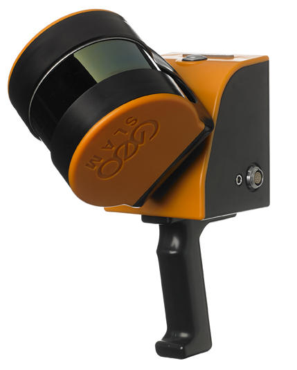
GEOSLAM- ZEB Horizon RT Handheld Scanner: Mjas Zenith
image source: https://www.aniwaa.com/
GEOSLAM ZEB Horizon RT is a revolutionary handheld laser scanner that empowers professionals in the surveying, mapping, and construction industries. With its cutting-edge technology and user-friendly design, the ZEB Horizon RT offers rapid and accurate 3D mapping capabilities in both indoor and outdoor environments. In this blog post, we will address the frequently asked questions about the GEOSLAM ZEB Horizon RT, providing valuable insights into its features, benefits, and applications.
What is the GEOSLAM ZEB Horizon RT?
The GEOSLAM ZEB Horizon RT is a lightweight and portable laser scanner that captures detailed 3D data of environments using simultaneous localization and mapping (SLAM) technology. It allows users to quickly and efficiently capture accurate point cloud data for various mapping and surveying applications.
What are the key features of the GEOSLAM ZEB Horizon RT?
The GEOSLAM ZEB Horizon RT incorporates several features that contribute to its exceptional performance:
- Simultaneous Localization and Mapping (SLAM): The ZEB Horizon RT uses SLAM technology to generate real-time, accurate 3D maps while in motion. This enables users to navigate and capture data simultaneously, significantly reducing surveying time.
- Lightweight and portable design: The handheld and lightweight design of the ZEB Horizon RT allows for easy transportation and maneuverability, making it suitable for indoor and outdoor scanning applications.
- Long-range scanning capabilities: The ZEB Horizon RT can capture data at a range of up to 100 meters, providing comprehensive coverage and allowing for efficient data collection in large-scale environments.
- Real-time data visualization: The scanner's built-in display allows users to visualize the captured data in real-time, ensuring data quality and completeness during the scanning process.
- Easy data integration and processing: The ZEB Horizon RT seamlessly integrates with various software solutions, enabling efficient data transfer and processing in popular industry-standard formats.
How does the GEOSLAM ZEB Horizon RT enhance productivity and efficiency?
The GEOSLAM ZEB Horizon RT offers numerous benefits that enhance productivity and efficiency in mapping and surveying workflows:
- Rapid data capture: The ZEB Horizon RT enables fast and efficient data capture, reducing the time required for surveying and mapping projects.
- Real-time visualization: The scanner's real-time data visualization feature allows users to identify gaps or areas that require additional data capture, ensuring data completeness on-site.
- Easy and intuitive operation: The user-friendly interface of the ZEB Horizon RT requires minimal training, enabling users to quickly familiarize themselves with the device and operate it efficiently.
- Versatile scanning capabilities: The ZEB Horizon RT is suitable for a wide range of applications, including building surveys, construction site monitoring, facility management, and as-built documentation.
- Seamless data integration: The scanner's compatibility with industry-standard software ensures smooth data integration into existing workflows, minimizing processing time and enhancing project efficiency.
What applications can benefit from the GEOSLAM ZEB Horizon RT?
The GEOSLAM ZEB Horizon RT finds applications in various industries, including:
- Construction and engineering: The scanner facilitates rapid as-built documentation, progress monitoring, and clash detection in construction projects.
- Architecture and interior design: The ZEB Horizon RT enables accurate 3D modeling of buildings, capturing detailed measurements for architectural design and interior planning.
- Facility management: The scanner assists in creating accurate 3D models of facilities for maintenance, space management, and renovation purposes.
- Forensic investigation: The ZEB Horizon RT can be used for crime scene documentation and accident reconstruction, providing detailed and precise 3D data.
The GEOSLAM ZEB Horizon RT empowers professionals in the surveying, mapping, and construction industries with its rapid and accurate 3D mapping capabilities. With its SLAM technology, lightweight design, long-range scanning capabilities, and real-time data visualization, the ZEB Horizon RT revolutionizes the way mapping and surveying tasks are performed. Whether you're a surveyor, architect, or facility manager, the GEOSLAM ZEB Horizon RT is a powerful tool that enhances productivity, efficiency, and data quality in your projects.


Comments
Post a Comment