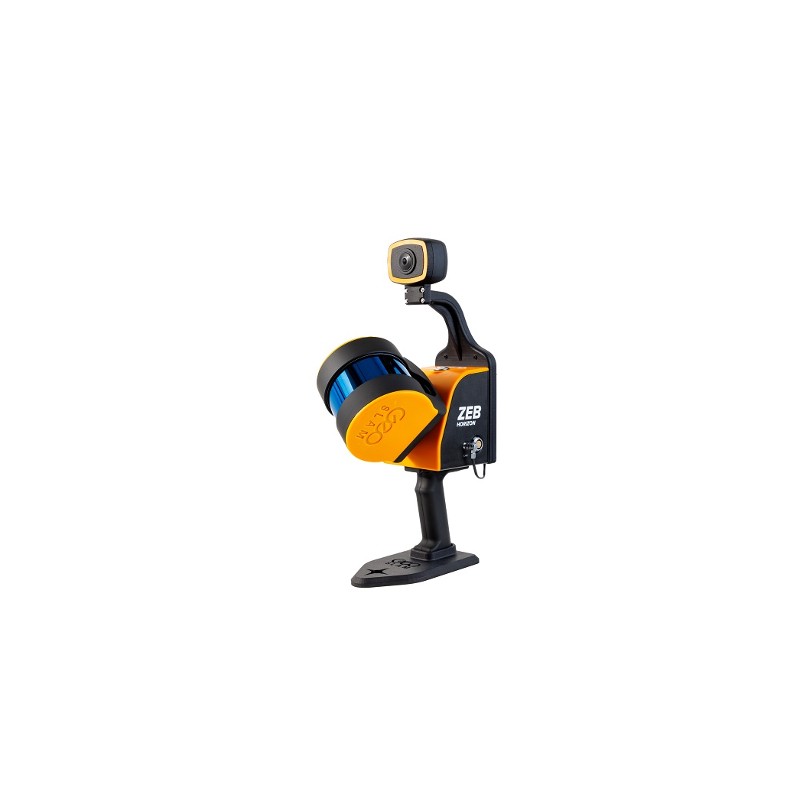
GEOSLAM- ZEB Vision: Mjas Zenith
image source: gmxgh.com
GEOSLAM ZEB Vision is an innovative handheld mobile mapping solution that revolutionizes reality capture in various industries such as surveying, construction, and engineering. With its cutting-edge technology and user-friendly design, ZEB Vision empowers professionals to efficiently capture and visualize high-quality 3D data of their environments. In this blog post, we will address the frequently asked questions about the GEOSLAM ZEB Vision, providing valuable insights into its features, benefits, and applications.
What is GEOSLAM ZEB Vision?
GEOSLAM ZEB Vision is a state-of-the-art handheld mobile mapping system that combines lightweight LiDAR scanning technology with advanced imagery sensors. It allows users to rapidly capture and process highly accurate 3D data of indoor and outdoor spaces with ease and efficiency.
What are the key features of GEOSLAM ZEB Vision?
GEOSLAM ZEB Vision incorporates several features that contribute to its exceptional performance:
- Simultaneous Localization and Mapping (SLAM) technology: ZEB Vision utilizes SLAM technology to enable real-time, on-the-fly data capture and visualization, delivering immediate results.
- High-accuracy LiDAR scanning: The integrated LiDAR sensor captures precise 3D point cloud data, ensuring accurate measurements and detailed representations of the environment.
- Integrated imagery sensors: ZEB Vision combines LiDAR data with high-resolution imagery, providing photorealistic textures for enhanced visualization and analysis.
- Lightweight and ergonomic design: The handheld form factor of ZEB Vision ensures easy portability and maneuverability, allowing users to capture data in tight or complex spaces.
- Rapid data capture and processing: ZEB Vision enables fast data acquisition and processing, saving time and streamlining workflows.
- User-friendly interface: The intuitive interface of ZEB Vision makes it accessible to users with varying levels of expertise, minimizing training requirements.
How does GEOSLAM ZEB Vision enhance productivity and efficiency?
GEOSLAM ZEB Vision offers several benefits that boost productivity and efficiency in reality capture workflows:
- Rapid data capture: ZEB Vision enables quick and efficient data acquisition, significantly reducing the time required for capturing 3D environments compared to traditional methods.
- Real-time visualization: The SLAM technology of ZEB Vision provides instant feedback on data quality, allowing users to validate the captured data on-site and make any necessary adjustments or additional scans.
- Comprehensive data representation: The integration of LiDAR data with imagery provides a rich and detailed representation of the environment, enhancing visualization, analysis, and decision-making processes.
- Versatile applications: ZEB Vision is suitable for a wide range of applications, including surveying, construction documentation, facility management, as-built documentation, and heritage preservation.
- Collaborative workflows: The processed data from ZEB Vision can be easily shared and integrated into existing software platforms, facilitating collaboration among team members and stakeholders.
What industries can benefit from GEOSLAM ZEB Vision?
GEOSLAM ZEB Vision finds applications in various industries, including:
- Surveying and mapping: ZEB Vision allows surveyors to efficiently capture and model topographic features, improving the accuracy and speed of surveying operations.
- Construction and engineering: The system aids in construction progress monitoring, quality control, clash detection, and as-built documentation, helping to streamline construction workflows.
- Facilities and asset management: ZEB Vision assists facility managers in accurately mapping and documenting infrastructure, supporting maintenance, space management, and renovation activities.
- Heritage preservation: ZEB Vision enables the creation of detailed 3D models of historical sites and buildings, facilitating conservation and restoration efforts.
GEOSLAM ZEB Vision is agame-changer in reality capture, offering rapid, accurate, and versatile 3D data acquisition capabilities. With its SLAM technology, LiDAR scanning, integrated imagery sensors, and user-friendly interface, ZEB Vision empowers professionals to streamline their workflows, improve productivity, and make informed decisions based on high-quality data. Whether you're in the surveying, construction, or facilities management industry, ZEB Vision is a valuable tool for efficient and effective reality capture.


Comments
Post a Comment